
The smartphone app “World Transit Maps” has begun offering a new function that displays markers on Japan railway route maps to indicate sections where service is suspended.
Suspended routes due to disasters are clear at a glance!
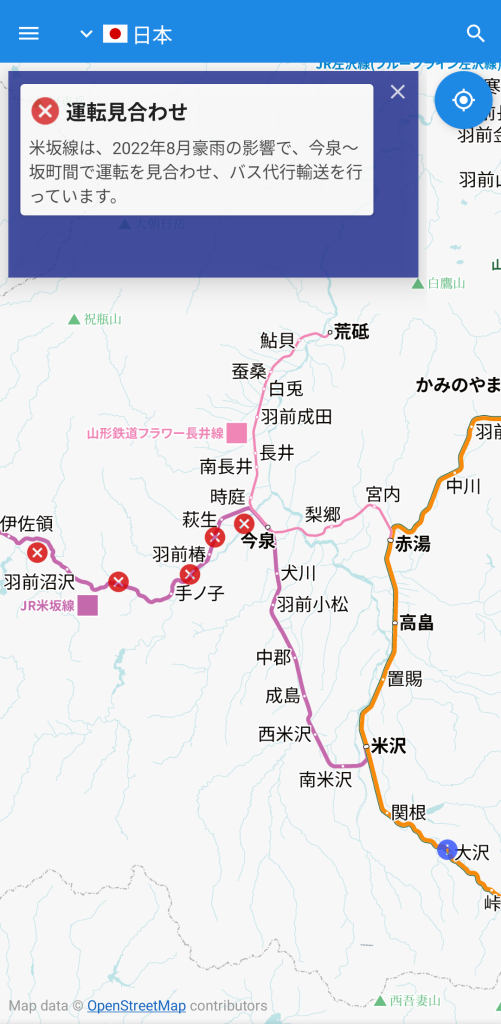
When planning a train trip, it is important to know which sections will be out of service for an extended period due to a disaster or other reasons. The latest version of our app displays markers such as an “X” on the corresponding section on the route maps, making it easy to see at a glance that there is some kind of operation information.
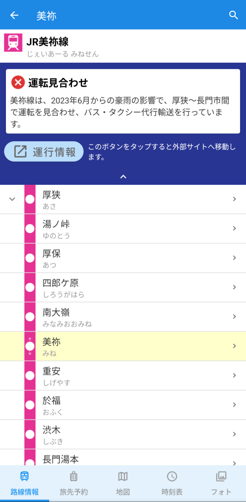
You can also check the cloased sections on the station details screen. Tap a station on the route map to open a list of lines departing from and arriving at that station. Tap the line name that displays “Operation Suspended” or “Notice” to view detailed information such as replacement buses and the resume schedule, which will help you choose your suitable route.
Increased information makes travel planning easier
This function is compatible with the new map format “tile format (v2)” that is available from November 2024. The previous “download format” maps are also displayed suspended sections, but the new function significantly enhances the amount of information and improves update frequency, further improving accuracy.
Highlights are displayed to indicate information about extended service suspensions due to natural disasters, bad weather, accidents, etc., as well as planned closure due to construction works.
At present, we are unable to provide real-time operational information such as sudden delays or disruptions to schedules due to accidents or vehicle breakdowns. We also put links to official operation status from railway operators, so please check the latest information before you set off.
Install


Supported Versions
To use the above, update your app “World Transit Maps” to version 8.4.0 or higher (for both Android and iOS).
Countries and regions where maps are provided in the app “World Transit Maps”
Asia
- Japan (v2)
- South Korea
- Taiwan (v1)
- Hong Kong (v1)
- Macau (v1)
- Thailand
- Malaysia
- Singapore
Europe
- United Kingdom
- France
North America
- United States
*(v1) supports “tile method (v1)”, (v2) “tile method (v2)”, and no mark “download method”.